New or recently announced disruptions
Keep informed and plan your travel options for any new or recently announced major disruptions listed below:

Cross River Rail will transform how we travel to, from and through Brisbane in the future.
And while that means the whole of South East Queensland can start looking forward to the benefits of Cross River Rail, right now it means changes to roads, footpaths and public transport services.
To find out what is currently happening now, follow the links below.

Keep informed and plan your travel options for any new or recently announced major disruptions listed below:
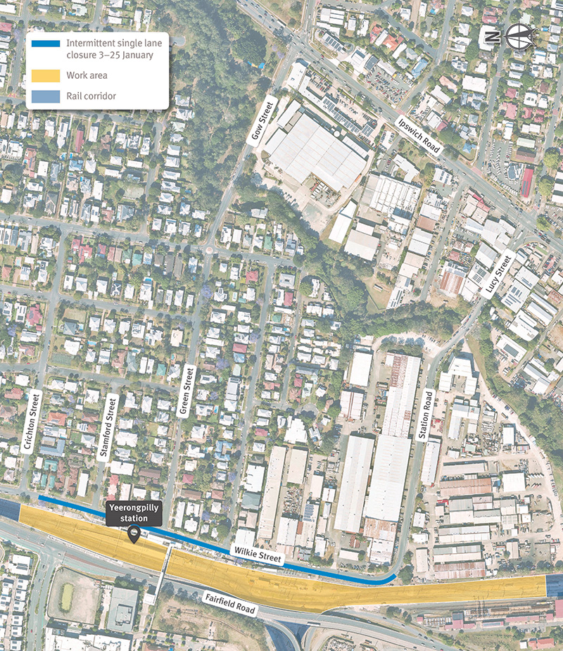
Works will only impact services on Mondays and Tuesdays.
March dates:
Works will only impact services on Mondays and Tuesdays.
March dates:
Works will only impact services on Mondays and Tuesdays.
March dates:
Works will only impact services on Mondays and Tuesdays.
March dates:
Works will only impact services on Mondays and Tuesdays.
March dates:
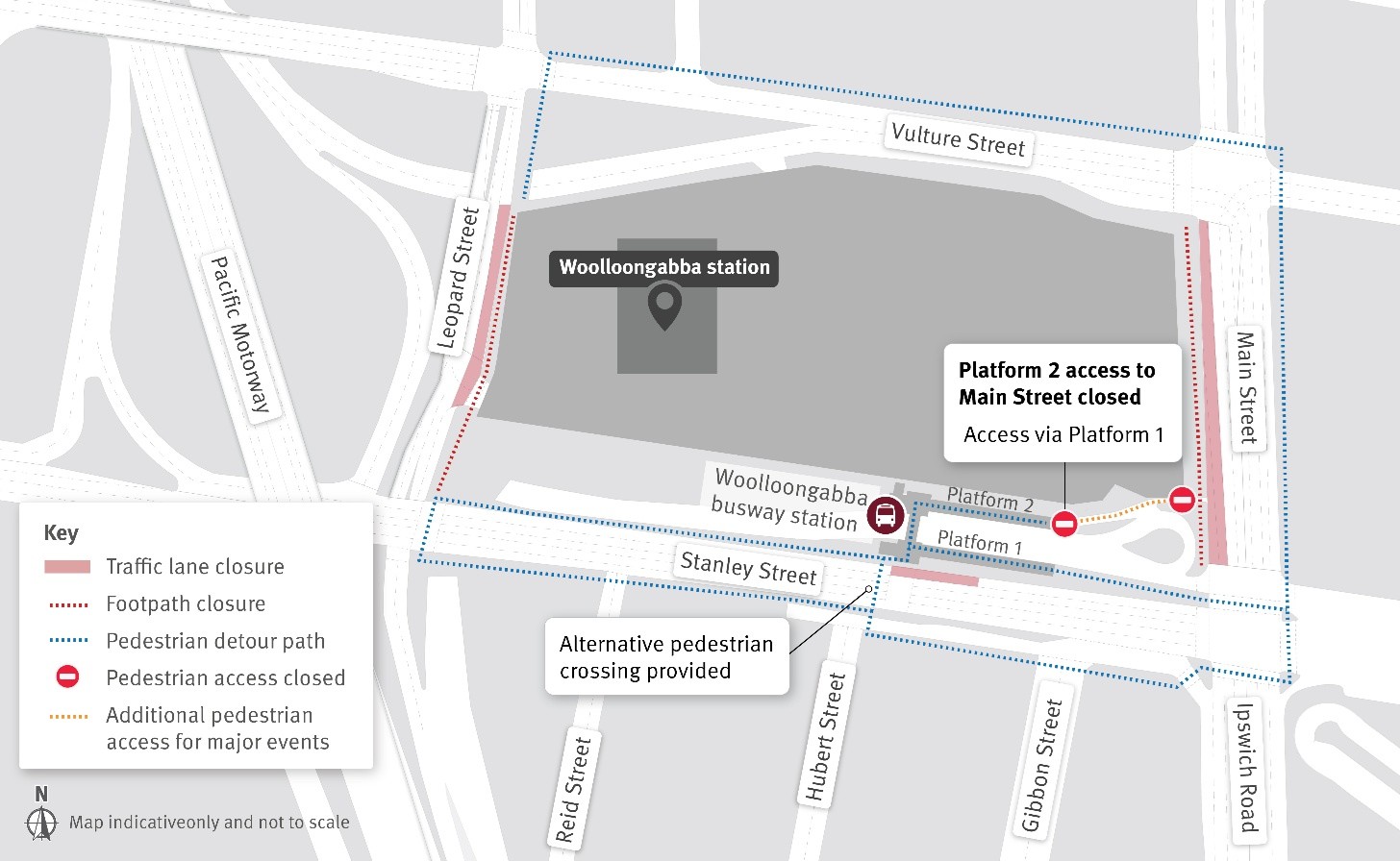
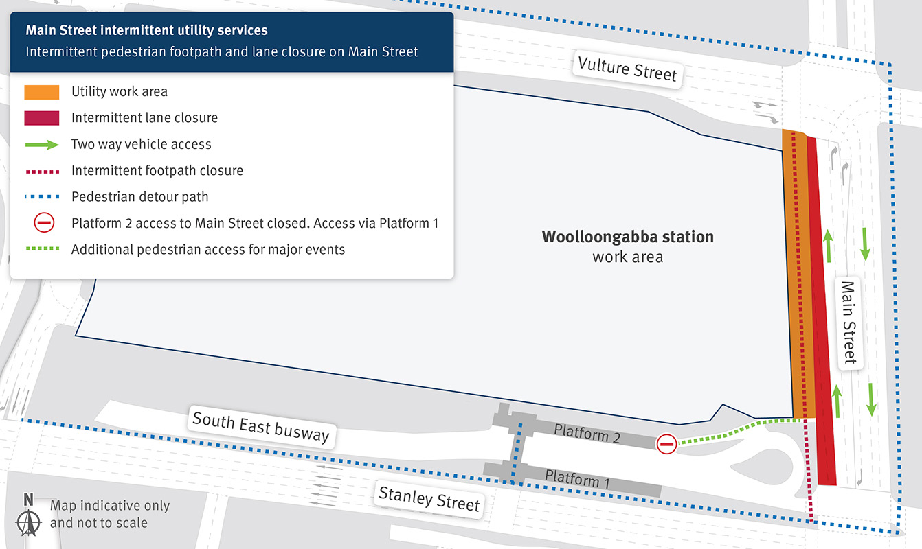
Access to Woolloongabba station
For major events:
All other times:
Works will only impact services on Mondays and Tuesdays.
March dates:
Works will only impact services on Mondays and Tuesdays.
March dates:
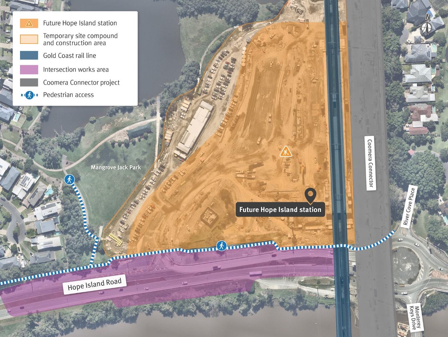
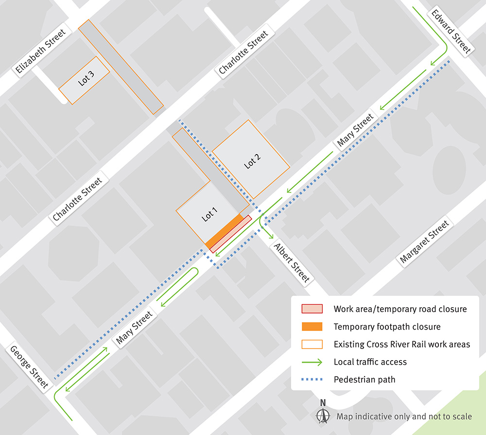 Click to enlarge
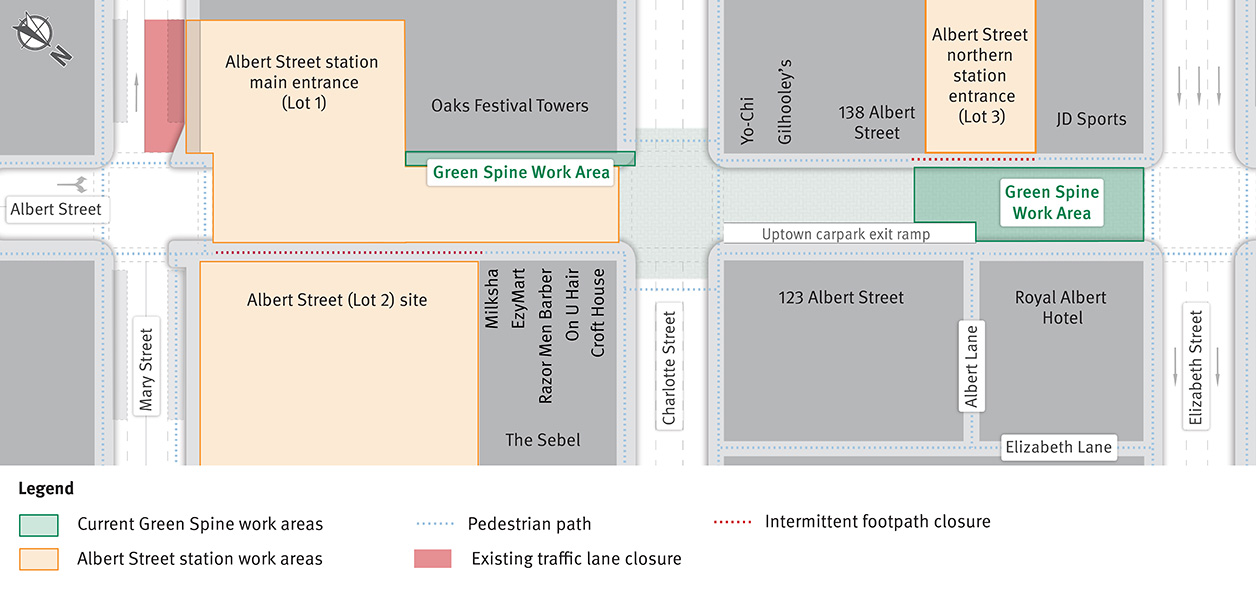
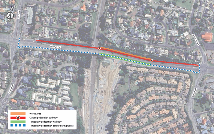
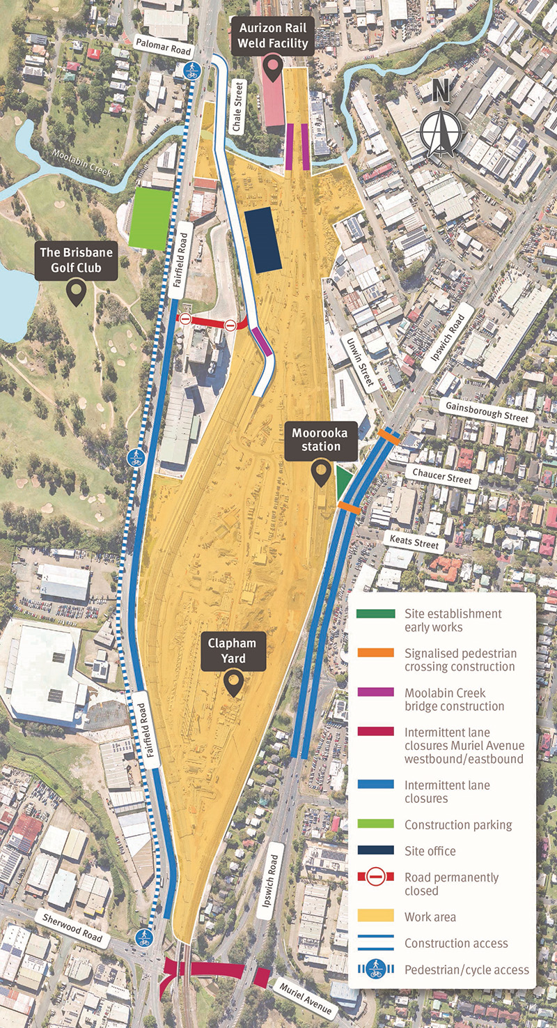
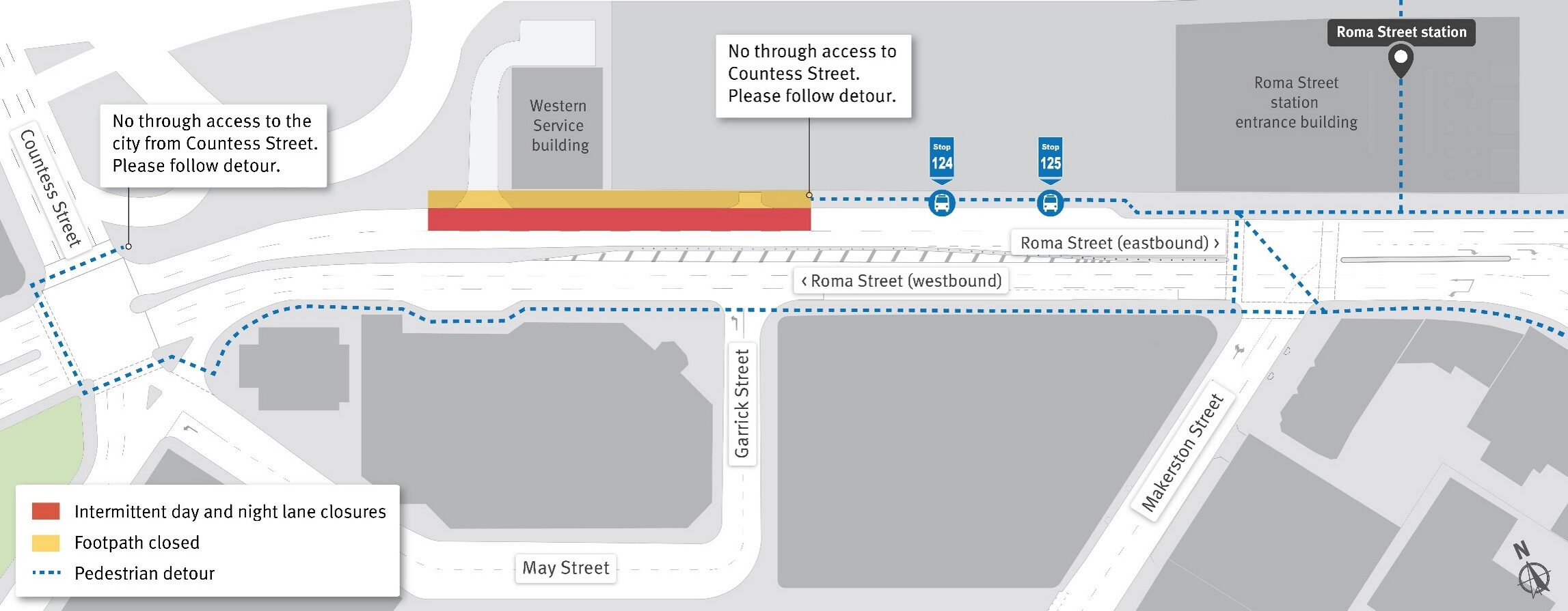
 Click to enlarge
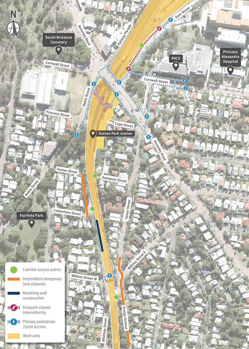
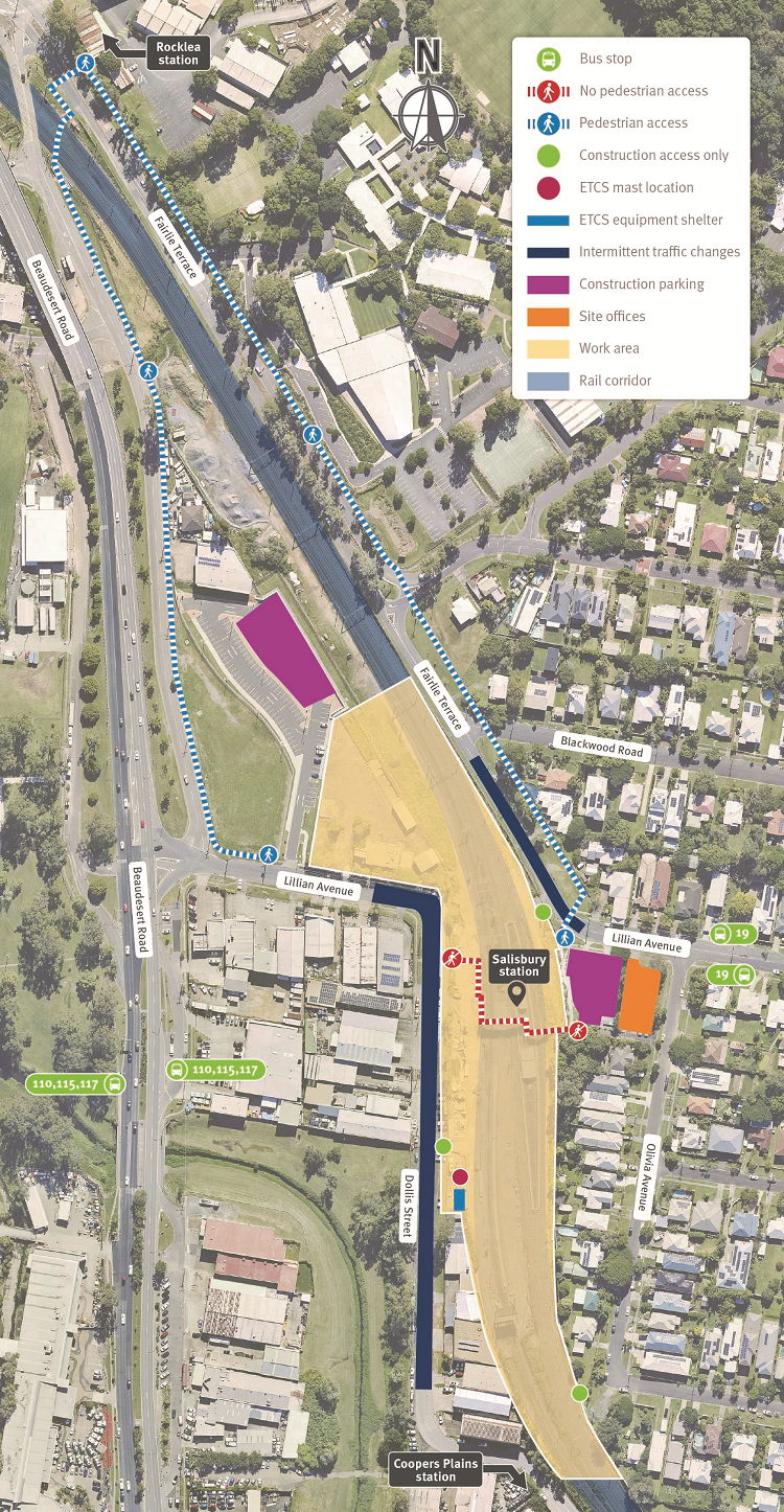
 Click to enlarge
 Click to enlarge
 Click to enlarge
 Click to enlarge
 Click to enlarge
 Click to enlarge
 Click to enlarge
 Click to enlarge
 Click to enlarge
 Click to enlarge
 Click to enlarge
 Click to enlarge


